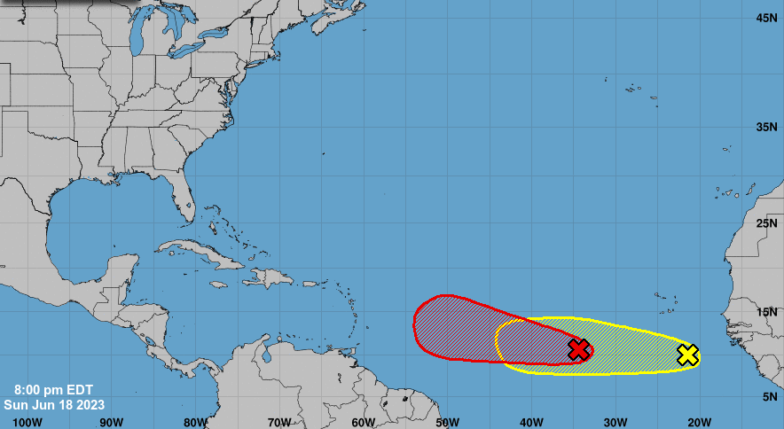
A tropical wave that emerged off the coast of Africa is likely to become a tropical depression in the next day or two as it pushes toward the Caribbean, according to the National Hurricane Center.
In its 2 p.m. Sunday update, the hurricane center increased the system’s chances of formation in the next two days to 90%.
The system, located several hundred miles southwest of Africa’s Cape Verde Islands, is continuing to produce a large area of disorganized showers and thunderstorms, the hurricane center said.
The latest path has it approaching the Leeward Islands, the eastern edge of the Caribbean, by late next week.
It is expected to move west at 15 to 20 mph across the eastern and central Atlantic, the hurricane center said in its Sunday update.
If it develops, it would become Tropical Depression Three. If its sustained winds reach 39 mph, it would become Tropical Storm Bret.
Meanwhile, in the 8 p.m. update, a second wave was shown to be emerging into the eastern Atlantic Ocean off of western Africa, with a 10% development chance in the next 48 hours and 20% over the next seven days.
Tropical Storm Arlene, which formed in early June and was short-lived, brought damaging winds and heavy rain to parts of South Florida and the Keys.
Experts predict 14 named storms, seven hurricanes and three major hurricanes to develop this hurricane season, which runs until Nov. 30.
A strong El Niño weather pattern is expected during the peak of this season, which can decrease cyclone activity in the Atlantic because of increased vertical wind shear. But ocean temperatures are the highest on record since 1979 based on recent 30-day averages, according to the forecast from Colorado State University released earlier this month.
The unusually warm temperatures could counteract the typically decreased activity during an El Niño.


